
A Rust map seed is useful information, but it is not the complete identity of a server world. Size, generation settings and the choice between procedural and custom terrain also matter. Even a matching landscape says nothing by itself about the bases, stock or player activity currently on that island.
When you reuse a map image or an old route, ask what the image actually represents. A preview can help you find a monument. It cannot prove that the path is currently clear, that the server uses the same settings or that a building from a previous wipe still exists.
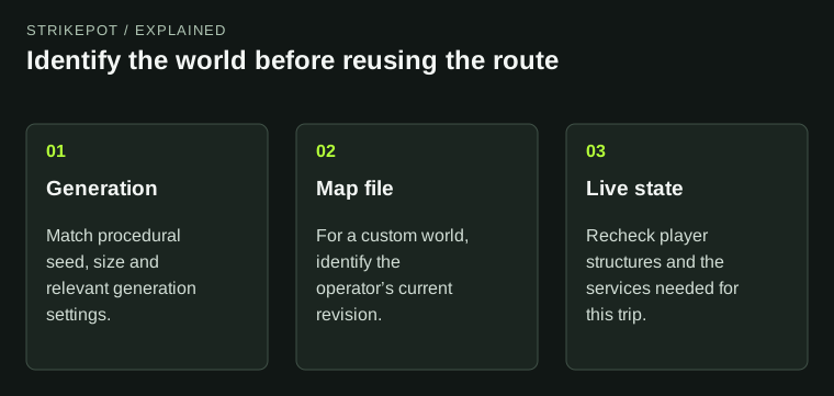
A map preview describes terrain; the live server supplies the situation on that terrain.
Terrain identity comes before route planning
Start by confirming the server and current map. Keep the world size with the seed rather than copying the seed as a stand-alone label. Then check whether the operator describes any custom generation choices.
The Facepunch-hosted generation reference documents controls for features such as roads, rail systems and biome proportions, along with ways to include or exclude prefabs. It also notes that some monuments depend on suitable tier or biome conditions. This is why a familiar-looking seed number is an incomplete explanation of a missing feature.
These are possibilities an operator can configure, not a claim that every community server changes them. Verify the chosen server's actual map before deciding that a preview is wrong or a monument has been removed from the game.
A custom map is a different source of terrain
A custom world does not become a standard procedural map because someone shares a number beside its name. The custom-map hosting documentation explains that this route uses a supplied map file and URL, with the ordinary procedural seed and size settings removed from that setup.
For a player, the practical question is which exact custom map version the server is serving. A map creator can publish revisions, and a reused title does not tell you that two files are identical. Use the operator's current reference instead of searching for a similarly named download.
If joining fails with a map error, the custom-map download guide covers the file-host problem. Route planning starts after the correct world is available; it should not require replacing local files or trying unrelated map downloads.
Separate the landscape from the live world
It helps to read a map in two layers. The landscape layer contains terrain and placed landmarks. The live layer contains the situation created during this wipe: bases, blocked approaches, available services and the people using them.
Imagine a hypothetical group sees an old image showing a convenient road between its intended build location and a trading monument. The road may still be a useful reference if the terrain matches. The group still needs to observe whether the route now passes a compound, whether its chosen building spot is available and whether the destination offers the service they need.
No map number resolves those live questions. Treat the preview as a navigation aid and the current server as the source for the present state. This avoids confusing an accurate terrain image with an out-of-date description of the session.
Compare recognizable features before copying coordinates
Begin with large, visible landmarks: the coastline shape, major roads and the monuments relevant to your task. Check more than one feature before trusting a precise location from an image. One similar bay is a weak match; several corresponding features give you a more useful basis for navigation.
Then inspect the route's endpoints. A location that works for a starter base may be unsuitable for a farm, a garage or a project that needs nearby infrastructure. Planning should follow the task you intend to repeat, rather than treating distance from one popular monument as a complete assessment.
| Evidence | Useful for | Still needs checking |
|---|---|---|
| Seed and size | Identifying a procedural-world reference | Generation settings and game context |
| Custom map name | Finding the operator's map description | The exact current file or revision |
| Matching landmarks | Confirming a route's terrain | Current obstacles and activity |
| Current in-game observation | Checking the immediate situation | How it may change later |
Use dates as part of the evidence
An old map image may describe a past generation or a previous custom-map release. Its date helps you decide what needs rechecking. It does not automatically make every part of the image useless; a familiar monument layout might remain relevant while the broader terrain differs.
Keep the version context when sharing a route. “This was the road we used last wipe” is an honest historical observation. “This road is safe now” is a new claim requiring current evidence. The difference matters most when another player will carry valuable gear based on your message.
Current monument systems can also impose requirements that a terrain image cannot show. For a Deep Sea trip, for example, use the lighthouse-access guide to check the gameplay state. A lighthouse icon does not itself confirm that the access condition has been completed.
Build a reusable note, not a permanent promise
A helpful group note includes the server identity, map type, seed and size when relevant, observation date and a short description of the intended route. Add any current dependency that could prevent the task, then refresh that dependency when you return.
If the server itself cannot be found, the server-browser guide can help separate a connection issue from a mistaken server identity. Avoid diagnosing changed terrain while connected to the wrong island.
The useful outcome is a route you can verify again. Matching world information gets you to the right landscape; present observations determine whether that landscape still supports the session you planned.